Contact Details
P.O. Box 278
Iqaluit, Nunavut CANADA X0A 0H0
- Phone: Phone: +1 867 975-4673 or +1 975-4643
- Fax: +1 867 975-4674
- Email: cen@cen.ulaval.ca
STATION NAME AND OWNER
The CEN Ward Hunt Island Research Station is co-owned and operated by the Centre d’études nordiques (CEN: Centre for Northern Studies; http://www.cen.ulaval.ca/en/) and Parks Canada (http://www.pc.gc.ca/index.aspx). It is the northernmost station in the CEN Network of research and climateThe average weather we would expect over a long period of time (seasons, years, decades). Climate varies from place-to-place across the Earth. Climate is determined by long-term (over at least... More monitoring stations.
LOCATION
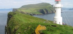
Ward Hunt Island is located at the northernmost tip of Canada, off the coast of northern Ellesmere Island and is within Quttinirpaaq National Park, Nunavut, Canada (83°06’ N, 74°10’ W). Quttinirpaaq means “top of the world” in Inuktitut and reflects this station’s location, situated about 750 km from the North Pole. It is adjacent to the thickest sea ice in the ArcticDefinitions of the Arctic vary according to environmental, geographical, political, cultural and scientific perspectives. Some scientists define the Arctic as areas having a high latitude, long winters, short, cool summers,... More Ocean, and the Canadian Marine Protected Area Tuvaijuittuq, meaning “lasting ice” in Inuktitut.
BIODIVERSITY AND NATURAL ENVIRONMENT
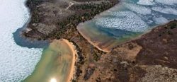
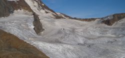
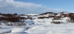
This island in the high arcticDefinitions of the Arctic vary according to environmental, geographical, political, cultural and scientific perspectives. Some scientists define the Arctic as areas having a high latitude, long winters, short, cool summers,... More is 6.5 km long (from east to west) and 3.3 km wide. The climateThe average weather we would expect over a long period of time (seasons, years, decades). Climate varies from place-to-place across the Earth. Climate is determined by long-term (over at least... More regime is typical of polar deserts, with dry and extremely cold temperatures (annual mean temperature of -17.3°C). The natural environment features lakes, ice shelves, fjords, epishelf lakes, ice caps and glaciers, sea ice, mountains, and valleys. The desert terrain has a low plant and animal diversity, but the region contains diverse microbial communities such as cyanobacterial mats that survive in these extreme environments. Past studies in this region are reviewed in: Vincent, W.F., et al. 2011: Extreme ecosystems and geosystems in the Canadian High ArcticDefinitions of the Arctic vary according to environmental, geographical, political, cultural and scientific perspectives. Some scientists define the Arctic as areas having a high latitude, long winters, short, cool summers,... More: Ward Hunt Island and vicinity (Ecoscience 18: 236-261, doi: doi:10.2980/18-3-3448). Recent climateThe average weather we would expect over a long period of time (seasons, years, decades). Climate varies from place-to-place across the Earth. Climate is determined by long-term (over at least... More impacts are summarized in: Vincent, W.F. and Mueller, D. (2020). Witnessing ice habitat collapse in the ArcticDefinitions of the Arctic vary according to environmental, geographical, political, cultural and scientific perspectives. Some scientists define the Arctic as areas having a high latitude, long winters, short, cool summers,... More. Science 370: 1031-1032, doi:10.1126/science.abe4491).
HISTORY AND FACILITIES
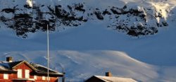
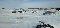
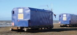
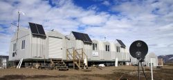
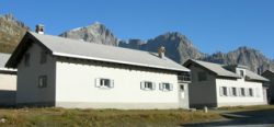
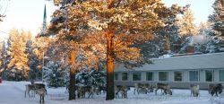
The first known sighting was in 1876 by Pelham Aldrich, a lieutenant with the George Nares expedition, and named for George Ward Hunt, First Lord of the Admiralty (1874-1877). Ward Hunt Island was briefly used as a weather station during the International Geophysical Year of 1957-58, and since then it has been used as the starting point for a number of attempts to reach the North Pole, beginning with Ralph Plaisted in 1968. Scientists have been working at the station since the 1950s. Parks Canada has three Weatherhaven shelters with oil burner furnaces, each can host 12 people for sleeping.
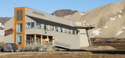
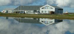
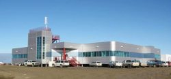
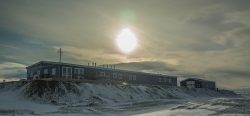
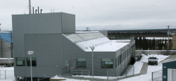
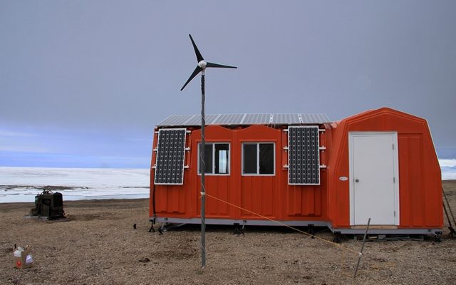
CEN operates an automated, year-round climateThe average weather we would expect over a long period of time (seasons, years, decades). Climate varies from place-to-place across the Earth. Climate is determined by long-term (over at least... More station in the SILA Network on the island, and automated cameras tracking changes in lake ice and fiord ice; these data are available in the Nordicana D archive (http://www.cen.ulaval.ca/nordicanad/en_index.aspx). A laboratory made of insulated fiberglass and powered by solar panels was built in 2010 through collaboration between the CEN and Parks Canada, and funded by a federal infrastructure grant.
GENERAL RESEARCH AND DATABASES
Main research fields include the structure and functioning of lake, river and glacial ecosystems at high latitudes, dynamics of northern ice shelves, microbial ecologyThe study of living organisms in their environment, including where they are found and how they interact with their physical environment and with each other, for example through food webs.... More, geomorphology of polar desert landscapes, and impacts of climate changeAccording to the United Nations Framework Convention on Climate Change, climate change is change in the climate of the whole Earth or a region of the Earth that is believed... More on aquatic ecosystems. Extensive climateThe average weather we would expect over a long period of time (seasons, years, decades). Climate varies from place-to-place across the Earth. Climate is determined by long-term (over at least... More data records are available online: http://www.cen.ulaval.ca/nordicanad/en_index.aspx
For requests concerning ecological monitoring data, please contact the Centre d’études nordiques (cen@cen.ulaval.ca)
HUMAN DIMENSION
No communities live on Ward Hunt Island, which lies 170 km to the northwest of the Canadian military base Alert. The nearest community is Grise Fjord, located 800 km away on southern Ellesmere Island. Grise Fjord (Inuktitut: Aujuittuq, “place that never thaws”) is a small Inuit hamlet in the Qikiqtaaluk Region in the territory of Nunavut, Canada. With a population of 141 residents (as of the Canada 2006 Census), it is the only Inuit community on Ellesmere Island.
ACCESS
Given that this is an extremely isolated station in a national park, all research activities must be planned and proposed at least one year in advance. Contact CEN for more information (cen@cen. ulaval.ca). For information on access and permits, contact Quttinirpaaq Park Manager (http://www.pc.gc.ca/pn-np/nu/quttinirpaaq/ plan.aspx) and the Polar Continental Shelf Program (PCSP) for appropriate application forms to access the site via chartered flights (http://polar.nrcan.gc.ca/).